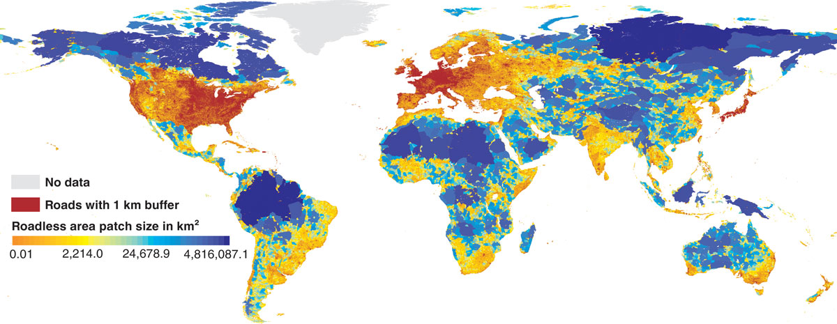
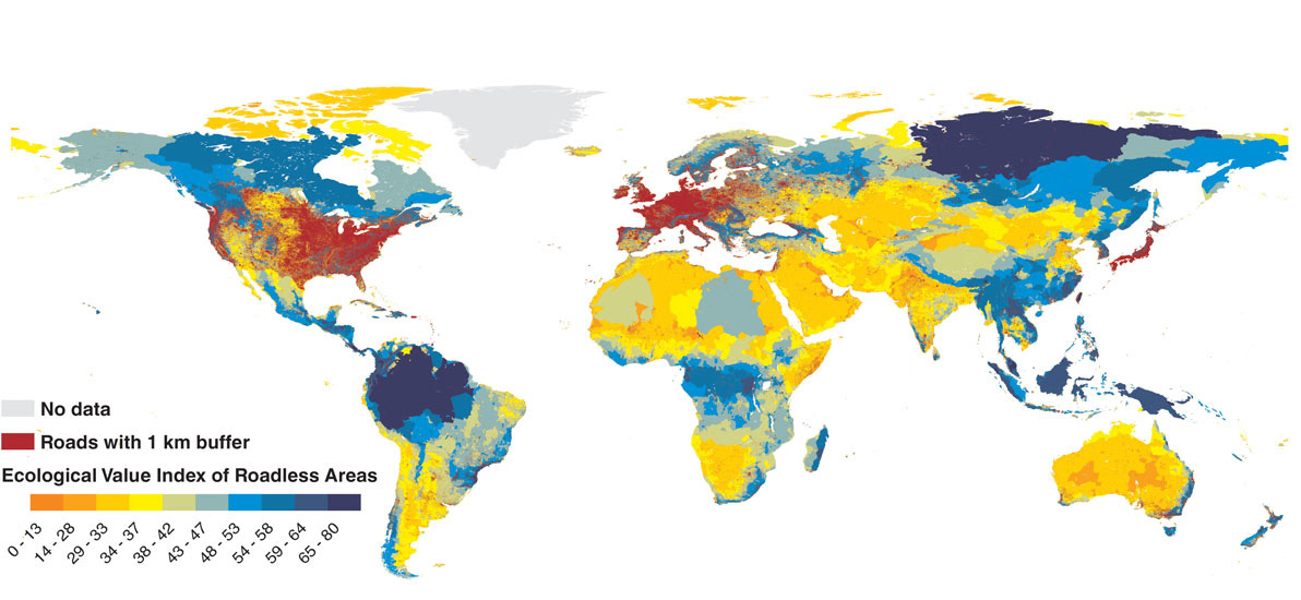
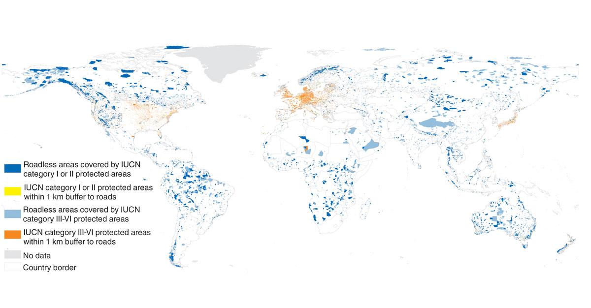
All roadless area data sets and maps are create on the basis of OpenStreetMap data, ODbL 1.0 and therefore if you use the dataset credit © OpenStreetMap contributors
"OpenStreetMap® is open data, licensed under the Open Data Commons Open Database License (ODbL) by the OpenStreetMap Foundation (OSMF)."
Please use the following credit when these data are displayed or used for further research:
Sources: CEEM/HNEE/OSM
Data download
Roadless Areas shapefiles (.zip)
- Africa roadless areas
- North and Central America roadless areas
- Europe roadless areas
- Asia roadless areas
- Australia roadless areas
- South America roadless areas
- Oceania roadless areas
- Global roadless areas
- Ecological Value Index of Roadless Areas (EVIRA)


All statistical analyses can be found in the supplementary material of the
publication "A global map of roadless areas and their conservation status":
http://science.sciencemag.org/content/suppl/2016/12/14/354.6318.1423.DC1
For more information please contact us.

INSENSA-GIS has been developed as a free to use and open-source software designed for:
- Statistical analysis of GIS data
- the development of weighted indices from different GIS data sets
- the testing of the robustness of created indices through standardized sensitivity analysis
- the display of results, tables and maps and
- the export of results and GIS data files in different formats


